|
The village of Le Rouget is a small village located center of France. The town of Le Rouget is located in the department of Cantal of the french region Auvergne. The town of Le Rouget is located in the township of Saint-Mamet-la-Salvetat part of the district of Aurillac. The area code for Le Rouget is 15268 (also known as code INSEE), and the Le Rouget zip code is 15290.
Geography and map of Le Rouget :
The altitude of the city hall of Le Rouget is approximately 600 meters. The Le Rouget surface is 8.23 km ². The latitude and longitude of Le Rouget are 44.854 degrees North and 2.234 degrees East.
Nearby cities and towns of Le Rouget are :
Cayrols (15290) at 2.34 km, Roumégoux (15290) at 2.71 km, Pers (15290) at 3.68 km, Omps (15290) at 4.24 km, La Ségalassière (15290) at 4.74 km, Parlan (15290) at 5.45 km, Saint-Mamet-la-Salvetat (15220) at 5.60 km, Glénat (15150) at 6.74 km.
(The distances to these nearby towns of Le Rouget are calculated as the crow flies)
Population and housing of Le Rouget :
The population of Le Rouget was 901 in 1999, 957 in 2006 and 964 in 2007. The population density of Le Rouget is 117.13 inhabitants per km². The number of housing of Le Rouget was 489 in 2007. These homes of Le Rouget consist of 401 main residences, 72 second or occasional homes and 16 vacant homes. |
|
|
Hotel Le Rouget
|
|
|
Book now ! Best Price Guaranteed, no booking fees, pay at the hotel with our partner Booking.com, leader in online hotel reservation.
Find all hotels of Le Rouget : Hotel Le Rouget
| |
|
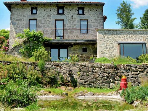
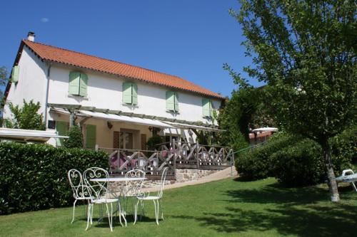
Guest accommodation : Le Domaine Dans La Prairie
Set in Le Sartre in the Auvergne region, Le Domaine Dans La Prairie features a garden. This holiday home offers free WiFi, water sports facilities, as well as a tennis court. T...
Address : 15290 Le Sartre
Distance Guest accommodation - Le Rouget : 6.64 km
|
|
|
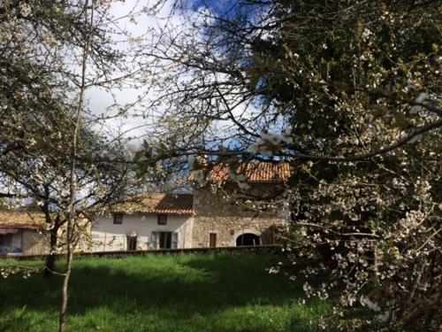
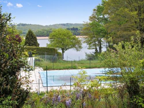
Guest accommodation : La Grange du Lac de Cantalès
Featuring a furnished garden, La Grange du Lac de Cantalès is an Auvergne holiday home set in Lacapelle-Viescamp, just 1 km from the La Cère Lake, a 2-minute drive from Puech de...
Contact : Le Rieu 15150 Lacapelle-Viescamp
Distance Guest accommodation - Le Rouget : 7.19 km
|
|
|
Hotel : Relais du Silence Auberge La Tomette

Relais du Silence Auberge La Tomette is located in the village of Vitrac in the Chataigneraie region. It offers peaceful accommodation surrounded by parkland with a heated swimm...
Prices : from 71.00 €
to 109.00 €
Contact : Le Bourg 15220 Vitrac
Distance Hotel - Le Rouget : 7.62 km
|
|
|
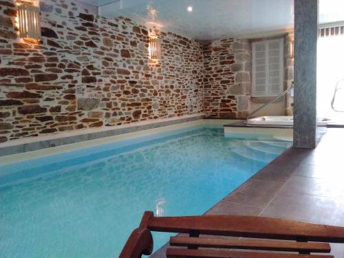
Guest accommodation : la Maison d'Odette et Daniel
La Maison d'Odette et Daniel is a holiday home situated in Vitrac, 40 km from Conques. Guests benefit from a terrace as well as access to a wellness centre featuring an indoor s...
Contact : Le Bourg 15220 Vitrac
Distance Guest accommodation - Le Rouget : 7.65 km
|
|
|
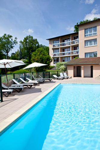
This 3-star family hotel has a bar, a terrace and a restaurant, which serves traditional French cuisine. It is in Lacapelle-Viescamp, 18 km from Aurillac Train Station. Hotel d...
Price : from 76.50 €
to 110.00 €
Address : Le Bourg 15150 Lacapelle-Viescamp
Distance Hotel - Le Rouget : 7.97 km
|
|

|
Guest accommodation : La Songeuse
Featuring accommodation with a terrace, La Songeuse is set in Saint-Gérons. Guests staying at this villa have access to free WiFi and a fully equipped kitchen. The villa is equ...
Contact : 15150 Saint-Gérons
Distance Guest accommodation - Le Rouget : 8.22 km
|
|
|
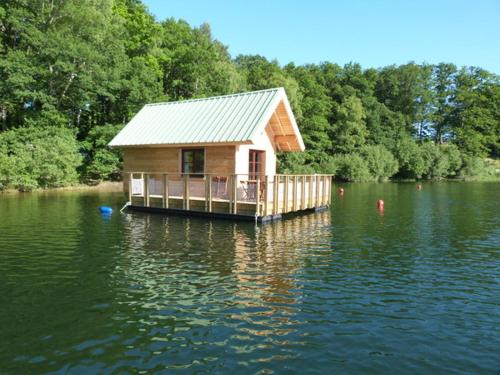
Guest accommodation : Les Chalets Flottants Des Planquettes
Les Chalets Flottants Des Planquettes is set in Saint-Étienne-Cantalès, 40 km from Conques. The chalets are located on a lake and accessible by rowing boat. Espinet beach is 5 m...
Contact : 18 Les Planquettes 15150 Saint-Étienne-Cantalès
Distance Guest accommodation - Le Rouget : 9.46 km
|
|
|
Guest accommodation : Chalet Lotissement des Pinèdes de Lacombe
Chalet Lotissement des Pinèdes de Lacombe is set in Saint-Gérons and offers barbecue facilities. The accommodation is 24 km from Aurillac. The chalet includes 3 bedrooms and a ...
Price : from 582.95 €
Contact : Lotissement des Pinèdes de Lacombe 15150 Saint-Gérons
Distance Guest accommodation - Le Rouget : 9.94 km
|
|
|
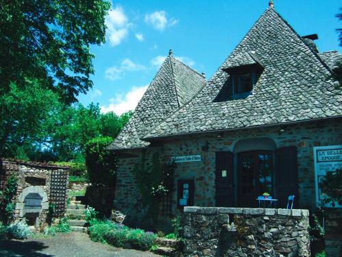
Bed and Breakfast : La Belle Epoque
In the Auvergne region, just 8 km from Aurillac, la Belle Epoque is a renovated old farm featuring an outdoor terrace and a garden. Free Wi-Fi and free parking are available, an...
Address : 50 Chemin de Lasfargues 15130 Sansac-de-Marmiesse
Distance Bed and Breakfast - Le Rouget : 10.67 km
|
|
|
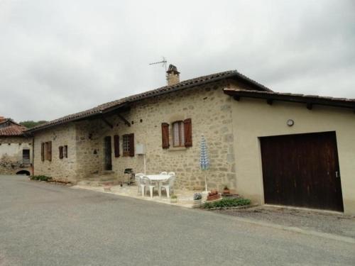
Guest accommodation : House La ségaline 1
House La ségaline 1 is situated in Saint-Hilaire. Guests staying at this holiday home have access to a fully equipped kitchen. The holiday home is equipped with a TV. Conques ...
Contact : Le bourg 46210 Saint-Hilaire
Distance Guest accommodation - Le Rouget : 10.80 km
|
|
Find another hotel near Le Rouget : Le Rouget hotels list
|
Map of Le Rouget
|
|
Map of Le Rouget :
At right you can find the localization of Le Rouget on the map of France. Below, this is the satellite map of Le Rouget. A road map, and maps templates of Le Rouget are available here : "road map of Le Rouget". This map show Le Rouget seen by the satellite of Google Map. To see the streets of Le Rouget or move on another zone, use the buttons "zoom" and "map" on top of this dynamic map.
Search on the map of Le Rouget :
To search hotels, housings, tourist information office, administrations or other services, use the Google search integrated to the map on the following page : "map Le Rouget".
Hotels of Le Rouget are listed on the map with the following icons: 
The map of Le Rouget is centred in the following coordinates :
|

|
|
|
|
Print the map of Le Rouget

Print the map of Le Rouget : map of Le Rouget
|
Photos Le Rouget
|
See all photos of Le Rouget :
Other photos of Le Rouget and nearby towns can be found here: photos Le Rouget
|
|
Le Rouget weather forecast
Find next hours and 7 days weather forecast for Le Rouget here : weather Le Rouget (with english metrics)
This is the last weather forecast for Le Rouget collected by the nearest observation station of Saint-Mamet-la-Salvetat.
Week Forecast:
The latest weather data for Le Rouget were collected Friday, 19 June 2026 at 19:01 from the nearest observation station of Saint-Mamet-la-Salvetat.
| Friday, June 19th |
31°C 18°C
0%
38%
|
Partly cloudy
Temperature Max: 31°C Temperature Min: 18°C
Precipitation Probability: 0%
Percentage of sky occluded by clouds: 38%
Wind speed: 16 km/h North-West
Humidity: 36%° UV Index: 7
Sunrise: 06:04 Sunset: 21:40 |
|
| | Saturday, June 20th |
33°C 17°C
8%
41%
|
Partly cloudy
Temperature Max: 33°C Temperature Min: 17°C
Precipitation Probability: 8% (Rain)
Percentage of sky occluded by clouds: 41%
Wind speed: 10 km/h North
Humidity: 35%° UV Index: 7
Sunrise: 06:04 Sunset: 21:40 |
|
| | Sunday, June 21st |
36°C 18°C
27%
33%
|
Mostly clear
Temperature Max: 36°C Temperature Min: 18°C
Precipitation Probability: 27%
Percentage of sky occluded by clouds: 33%
Wind speed: 7 km/h North-West
Humidity: 34%° UV Index: 8
Sunrise: 06:04 Sunset: 21:40 |
|
| | Monday, June 22nd |
36°C 19°C
0%
21%
|
Mostly clear
Temperature Max: 36°C Temperature Min: 19°C
Precipitation Probability: 0%
Percentage of sky occluded by clouds: 21%
Wind speed: 6 km/h Sout-East
Humidity: 35%° UV Index: 8
Sunrise: 06:04 Sunset: 21:40 |
|
|
Attribution: 
|
|
Other maps, hotels and towns in france
Find another town, zip code, department, region, ...
Quick links Le Rouget :
Make a link to this page of Le Rouget with the following code :
|
|
|
 French Version : http://www.cartesfrance.fr/carte-france-ville/15268_Le Rouget.html